
* Mobile users: our previews are available at the bottom.*
HCSR maps contain latest development proposals, projects/townships under construction, new land alienation, new road proposals and more, including recent & historical property transaction data and land bank ownership.
Our cadastral lot based maps are highly editable to user’s liking and are vector formats. Users are able to hide or highlight any data-layered (such as different land use type, infrastructures and also text labels).
Our maps come in both hard & soft copies.
We have wall sized hard copies as well as bundles of A1 sized maps.
The soft copies are available in AutoCad, MapInfo, CorelDraw & PDF Formats.

Greater KL 2025
► Roll Map : Land Use & Aerial Photo Sample (A1 size booklet)
► Wall Map Sample (2025)(5.5 ft x 5 ft)
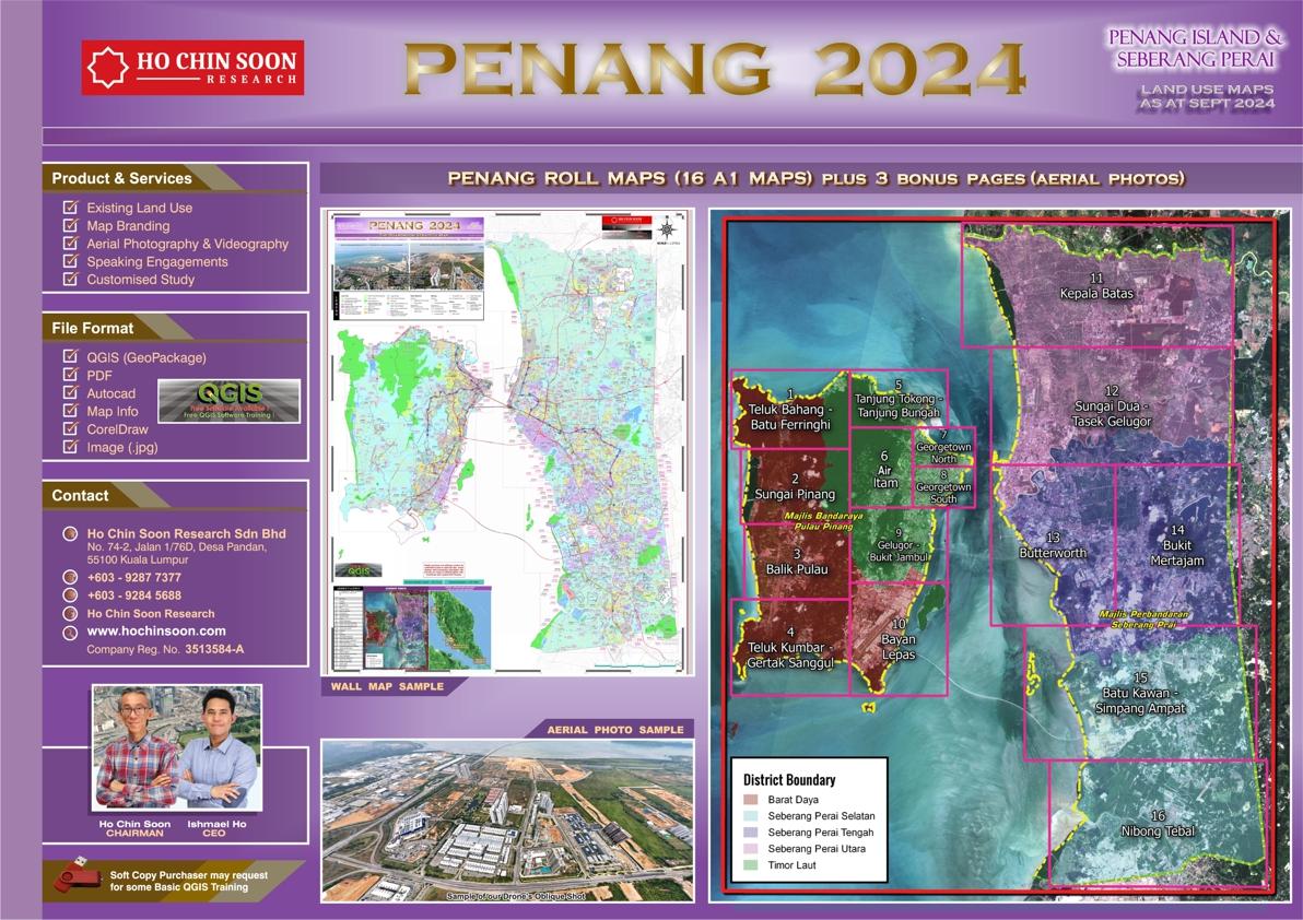
Penang Island 2024
► Roll Map : Land Use & Aerial Photo Sample (A1 size booklet)
► Wall Map Sample (2024) (5.5 ft x 5 ft)
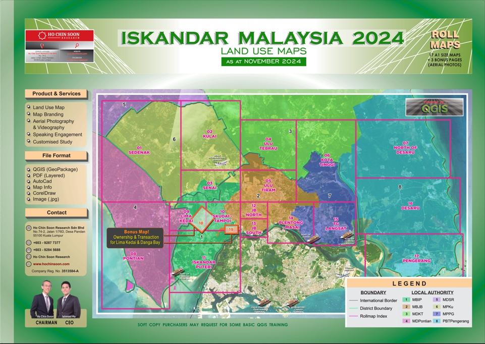
Iskandar Malaysia 2024
► Roll Map : Land Use & Aerial Photo Sample (A1 size booklet)
► Wall Map Sample (5.5 ft x 5 ft)
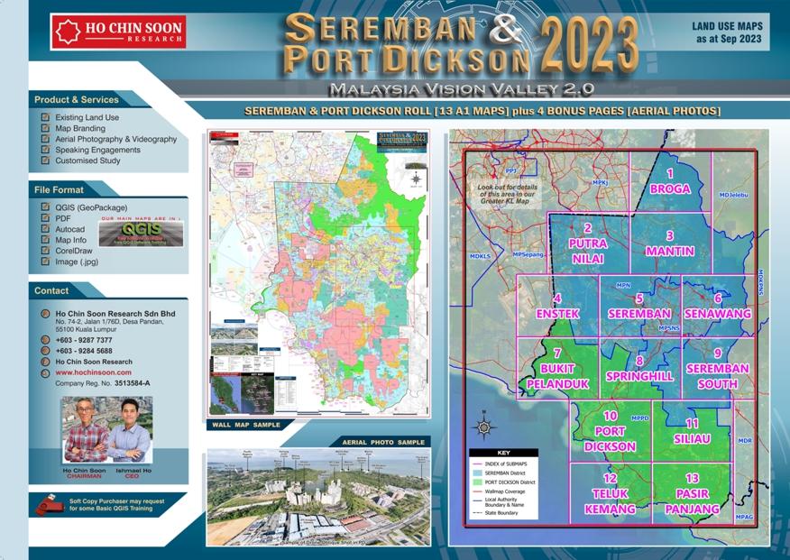
Seremban & Port Dickson 2023
► Roll Map : Land Use & Aerial Photo Sample (A1 size booklet)
► Wall Map Sample (5.5 ft x 5 ft)